Penitential Pilgrimage for Acadians, Black Loyalists and Slaves: A Dark Chorography of Nova Scotia
Robert Lawrence France
About
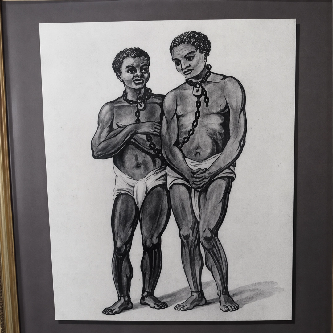
Medieval pilgrimages were often undertaken as penance for personal sins. In Penitential Pilgrimage for Acadians, Black Loyalists and Slaves: A Dark Chorography of Nova Scotia, internationally published pilgrimage scholar Robert France explores the concept of pilgrimage as penance for inherited or societal sins. Acadians were the original French-speaking European settlers of Nova Scotia who were forcibly removed from their lands by the British between 1755 and 1763 during the colonial wars. Black Loyalists were African slaves from the American colonies who were given their freedom and land by swearing allegiance to the Crown during the Revolutionary War. Unfortunately, their treatment for that loyalty was so poor that many chose to abandon Nova Scotia to establish the colony of Freetown in Sierra Leone. Moreover, despite Canada’s self-congratulatory belief that it has always been a haven for escaped slaves, the reality is that Nova Scotia was built on the backs of hundreds of those who remained enslaved and were subject to all the brutality of that existence.
Dr. France’s reason for undertaking this 600-kilometre walking pilgrimage of the Nova Scotian coastline is that he had forebears who worked and thrived in Bristol during the Eighteenth Century, and no one did so there and then without being tainted by the slave trade. As well, he had an ancestor who was a soldier with the British forces in Nova Scotia at the time of the ethnic cleansing of the Acadians. The pilgrimage was therefore an embodied means in which to learn and confront disreputable aspects about British imperialism. The methodology used revives the nearly forgotten antiquarian tool of chorography which spatializes history by creating a polychronic narrative in which the travelogue of the walk is interrupted by scholarly essays—in a sense, blending the experience of the present (heritage) with knowledge of the past (history).
The intention was to fracture the community of the Acadians and destroy their identity as a distinct people. The operation to remove the Acadians would cost thousands of lives and years of suffering and wandering, and must be marked down as one of the most horrific episodes in North American history.”
—A Great and Noble Scheme: The Tragic Story of the Expulsion of the French Acadians from their American Homeland (J. Faragher, 2005)
Generally speaking, few [Loyalist] blacks received any land at all, and when they did it was in smaller quantities than promised, contained some of the province’s worst soil, and was often located so far from major settlements that establishing a viable farm upon it or even visiting it was extremely difficult.”
—The Black Loyalists: The Search for a Promised Land in Nova Scotia and Sierra Leone 1783-1870 (J. Walker, 1999)
The Maritimes began as a society with slaves and remained so until slavery ended there in the 1820s.”
—North to Bondage: Loyalist Slavery in the Maritimes (H. Whitfield, 2016)
An itinerary, the description of a perambulation along a road, is one kind of representation of a transect through a region that reveals the folding of people and place/event.”
—The Archaeological Imagination (M. Shanks, 2012)
Paths form an essential medium for the routing of social relations, connecting up spatial impressions with temporally inscribed memories.”
—A Phenomenology of Landscape (C. Tilley, 1994)
If we believe that writers are influenced by places as well as texts, it makes sense that a careful scholar, as a matter of credibility and authority, should check those sources, making use of what Simon Schama calls, [in Landscape and Memory], ‘the archive of the feet.'”
—Story Line: Exploring the Literature of the Appalachian Trail (I. Marshall, 1998)
For the wayfarer in the landscape, as in the…text, particular sites marked by recognizable features would serve as place holders for…characters and stories… By visiting these sites, one would recall the stories and meet the characters as though they were alive and present, harnessing their wisdom and power to the task of crafting one’s own thought and experience, and of giving it sense and direction.”
—Being Alive: Essays on Movement, Knowledge and Description (T. Ingold, 2011)
Complete route
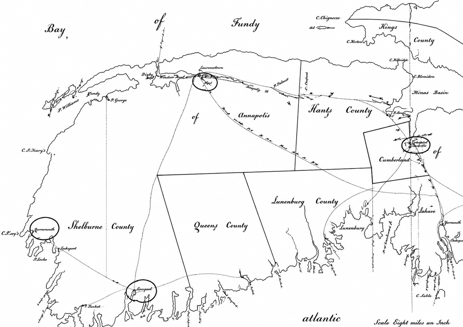
Eighteenth-century map of Nova Scotia showing inland roads and post houses. The pilgrimage route began in Shelburne (circled town at bottom-left) and progressed in a clockwise direction along the coast to Yarmouth (circled town at central-left) [Part I], from where it continued largely along the coast to Annapolis Royal (circled town at top-central) [Part II], and then onward largely along the coast to finish in Windsor (circled town at top-right) [Part III].
Part I
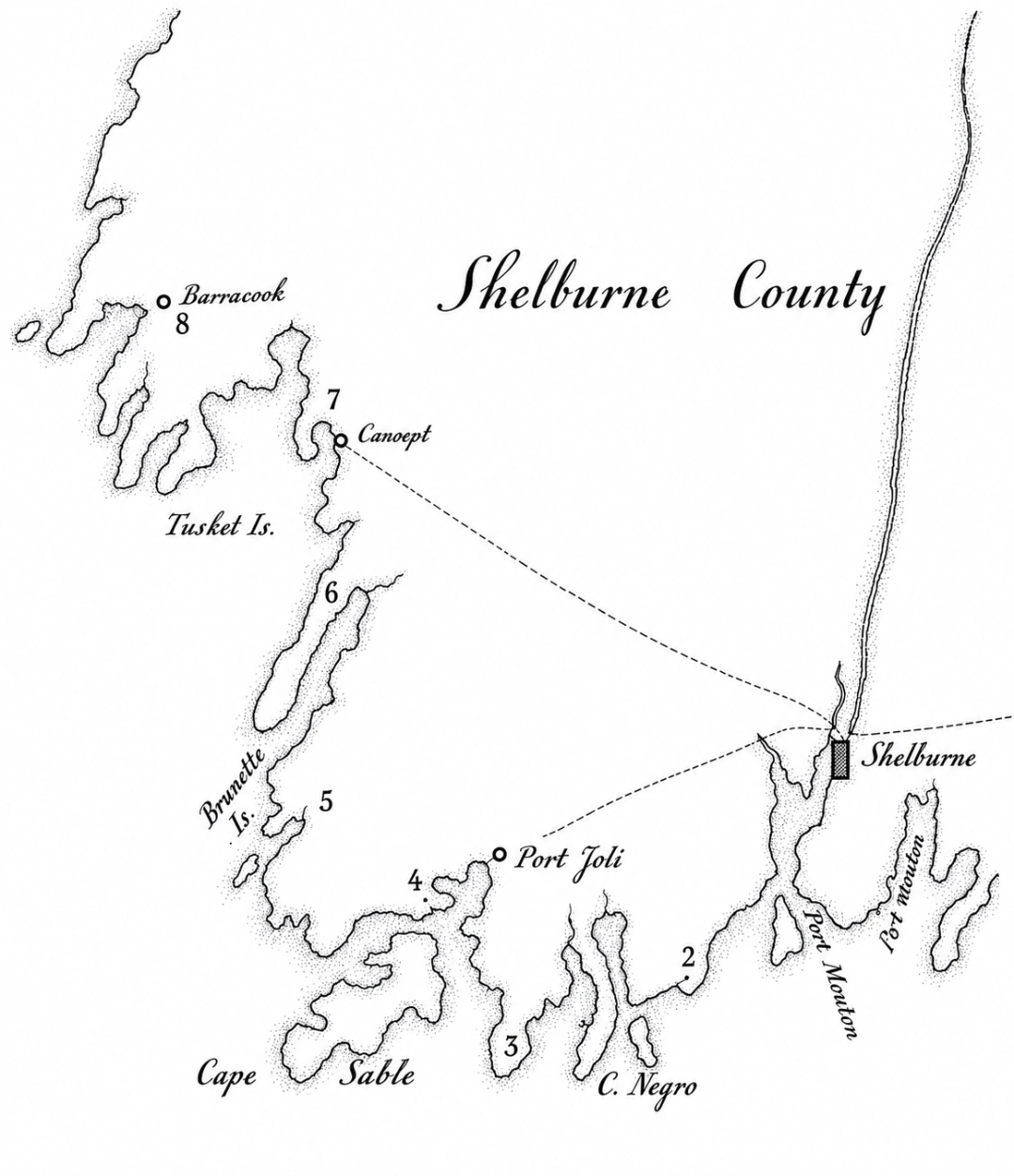
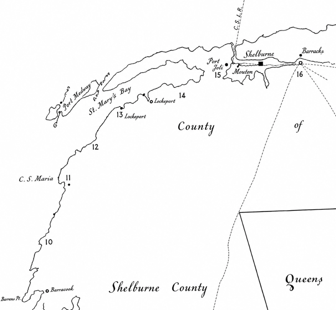
“Left-fold” pilgrimage between Shelburne and Yarmouth showing approximate location of walks for days 2 through 8 superimposed on the eighteenth-century map.
Part II
“Centre-fold” pilgrimage between Yarmouth and Annapolis Royal showing approximate location of walks for days 10 through 16 superimposed on the eighteenth-century map.
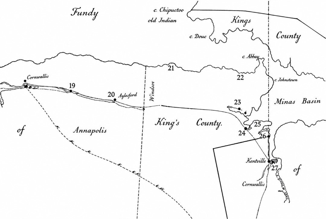
Part III
“Right-fold” pilgrimage between Annapolis Royal and Windsor showing approximate location of walks for days 19 through 27 superimposed on the eighteenth-century map.